The end of a mighty journey nearly insight, I set my sights on the forrest and loose sight of the trees...
Time to finish this thing up. First, a lost photo of Idaho:
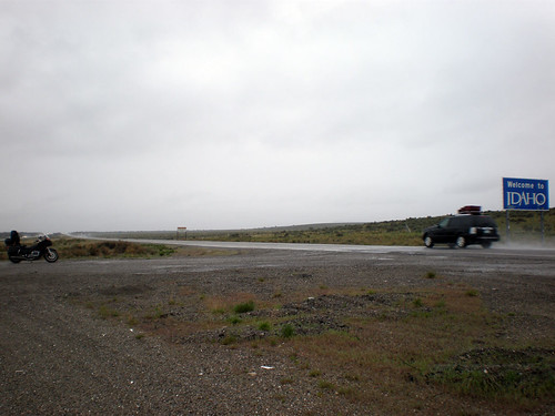
Utah and Idaho both sucked. It was time for things to take an upturn; after all it couldn’t be worse.
Leaving Idaho going into Oregon on Hwy-84 was a fairly uninteresting trip aside from some mild traffic. The skies were finally clear and picturesque, so I was having a good ride. Here’s a shot taken on the 84 at a rest stop:
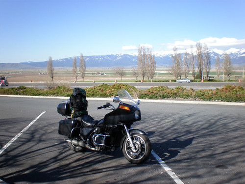
So my plan was pretty uninventive. I planned on taking HWY-84 to HWY-82 North into Washington and keep heading northwest until the 82 turns into the 90 and hooks up with I-5 in Tacoma. I would be home early, and wouldn’t get to see all that much; but I was pretty done with adventure so I was just looking for the easy way home. Here’s the plan:
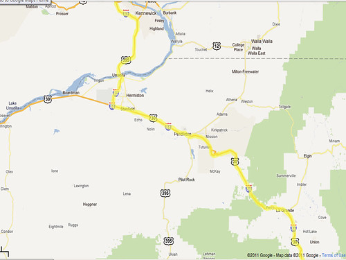
The plan went out the window pretty quick…
Here’s what happened:
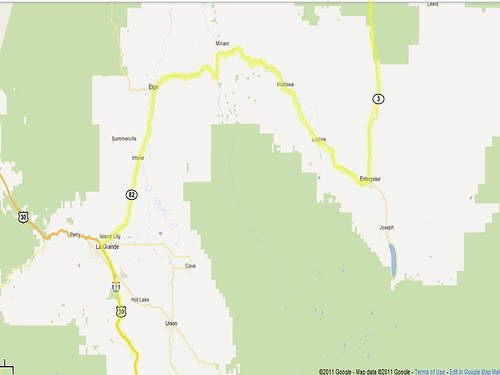
I was on the hunt for I-82 just outside of Pendleton. I wasn’t too shaken up by seeing HWY-82 well before Pendleton so I took it expecting to get where I was planning on going. I was nearly to Enterprise when I was tipped off to my incorrect directions by the HWY-82 East signs. I thought it was a little odd to be going east on what the map showed as a westbound road. It wasn’t until I was getting gas in Enterprise that the gentleman pumping my gas pointed out exactly where I was on a map. In attempting to get my bearings and make a decisive plan for getting home, he was quite sure that I would love hwy-3 north into Oregon. Boy, he sure was right!
I’m getting ahead of myself a bit though. My accidental detour took me thru Hells Canyon on some incredible piece of road; long, sweeping turns with minimal traffic and views of the canyon and river the whole time. At the bottom there’s a short stretch following the river with plenty of pullout spots. It’s really a bikers dream. Then it was onto the 3 north to Oregon. This was a beautiful road, starting with a gently elevation gain to the top of Joseph Canyon where the scenic vistas are abundant:
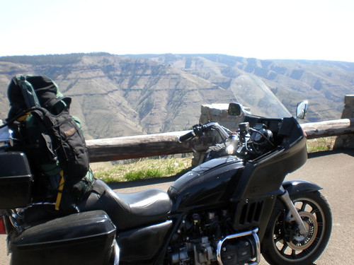
Same spot, different view:
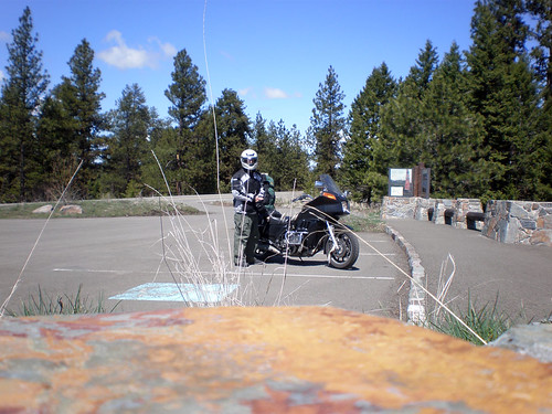
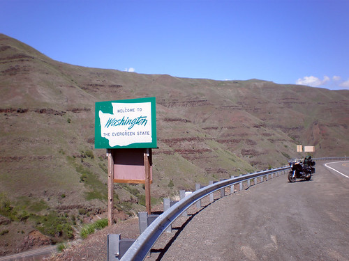
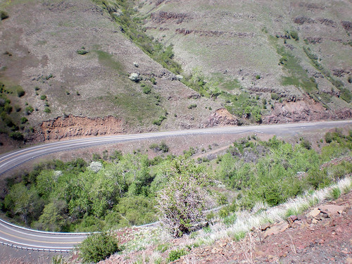
About 12 miles from the Washington state line the road takes a turn for the better. Tight downhill turns with plenty of asphalt for over correction. This goes on for something like 25 miles to the town of Astin (which is the only fuel stop between there and Enterprise). Pictures:
Here’s the kind of road I was dealing with:
And finally here’s my lunch stop in Astin (also note my air filter hanging off my pack):

Leaving Astin you get to follow the river for a short time until you start to pick up elevation and the terrain looks a little like what I left behind in Arizona. I carefully planned my route back, as I would be running short on time if I made another mistake and took HWY-12 which turns into the 261 west. Once again, I was greeted by a pleasant, unexpected surprise.
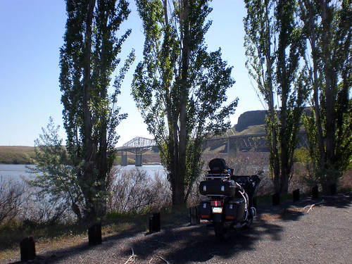
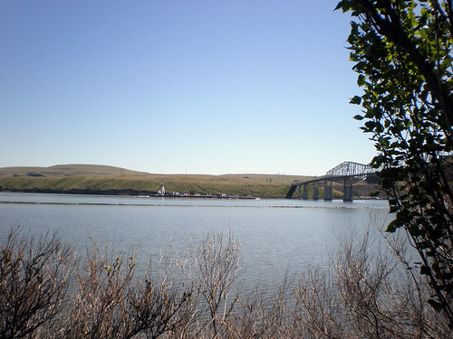
The 12 turns into the 261 and crosses a river (it’s actually a lake; because it’s dammed, but looks just like a river) where the Lyons ferry crosses. The ferry is only for cargo and apparently doesn’t make a whole lot of trips across the water. I was lucky enough to get to see it crossing while I was stopped to relieve myself. My rest stop was the Lyons Ferry Park which happened to be closed for the season. The Wing was nimble enough to fit between the rocks keeping cars from going thru the gate, so I had the place all to myself. If I was running a lot later I would have love to stay the night here, but as it turned out, I only got a chance to take a quick dip in the water and take off the layers I was still wearing from the morning ride. I would really like to re-visit this place during the normal season and maybe bring a boat.
Wing and Lyon’s Ferry Bridge:
Lyon’s Ferry Bridge and the Lyon’s Ferry:
The next part of the trip was highly uneventful. I took great joy in finding a part of the state I NEVER would have found otherwise, but it came at a cost. The ride thru east Washington was hot, flat, and booooooooooring. The most interesting thing I saw for about 5 hours was a 40 year old lady in a convertible with a bikini top on. I didn’t take a picture….
The 260 gave way to the 261, which I took to the 17 and then the 26 to I-90. All of this was in flat farmland that wasn’t even in season, so the normally green pastures were nothing but dust bowls. Not much to see, but I did master the art of leaning back into my backpack and putting my feet up on the crash guards.
The 90 got more scenic as I approached the eastern Cascade Mountain Range. At one point I had a great view of Mount Rainier while I was coming into the mountains, but I didn’t get a picture of that. Here’s a shot of Snoqualmie Pass:
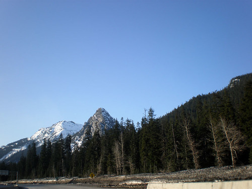
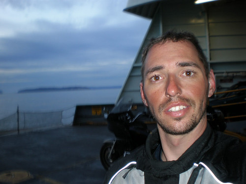
The 90 took me to the 405 which took me to the I-5 and I’d already been there, so the adventure was mostly over right then without much fanfare. I took the Ferry back to Whidbey Island and arrived at home about 45 minutes after dark.
Ferry:
I’m no longer a young man and I’ve always been a world traveler, but this trip has by far been the best of my life. I left thinking it would be an uneventful trip south followed by a return trip on the same route; and blew myself away by testing my abilities as both a rider and a mechanic. I can truly say that I learned something about myself, my machine, and my surrounding on this trip. An adventure I wouldn’t trade for anything in the world.
My parting shot is this: my odometer read at the end of the trip, I started with a reading (as hard as it is to believe) of 51,000 exactly.
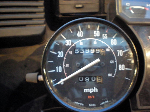
I was asked afterward why I didn’t circle the block for one mile to get it to an even three-thousand. I didn’t have a good answer at the time, and I don’t now either…I suppose I need to take another trip to break the 3k mile mark, Canada maybe?


